Meet Details
HQ
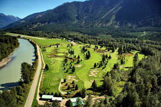
Competition Headquarters is at the Meadows At Pemberton Golf Course, 1730 Airport Road, Pemberton, BC. Competitors will meet there each morning and evening.
(find a map here_)
The Golf Course REMAINS OPEN TO THE PUBLIC!
All Welcome!
LAUNCH
Spectators can view flying activities from almost anywhere in the Valley. We do not recommend driving up to the Upper Launch - it is a steep, rough 4x4 only road. The Launch area will be a very busy place with complex activities during launch phase - pilot and supporter's safety is paramount! For safety reasons, spectators will NOT be allowed onto the competition launch area under any circumstances.
IMPORTANT: The road to launch MUST be kept clear for emergency vehicles!
The Lower Launch will provide great views during the races. Public lands near the day's Designated LZ will be good places to watch flight activity near the end of a day's racing. Spectators will NOT be permitted to enter any designated or alternate LZ, and must park safely off the road, away from the LZ, out of traffic.
Please be courteous with residents, livestock, and traffic. Be respectful of private property, working farmers and their crops, and important farming activities.
The Interactive Map will show the day's flight path and designated landing zone (LZ).
SITE DETAILS
SITE: McKenzie Mountain
COMPETITION SITE: 1250m ASL, WSW facing, large size, 5-6 wings across
LOCAL FREQUENCY:146.415
SITE RULES: HPAC & WCSC memberships are REQUIRED - NO EXCEPTIONS!
HAZARDS:
WHISTLER EXPRESS (wind). This site gets strong inflow, usually flowing in from the Whistler Valley. Both launches are in somewhat sheltered basins and it may not be possible to detect this wind on launch. Regardless, there may be strong turbulence just out front. The best marker for this is the big white windsock on “the Dome” out front of the lower launch. If it is outstretched from a South (wind from the left looking from launch) avoid launching into it. If you are already in the air and returning to land, call for radio confirmation of wind conditions in the LZ. Also look for wind-sign on Mile 1 lake (at Whistler Valley entrance), wind in the cottonwood trees near Pemberton (they go silver on the upwind side in strong wind). If the wind has arrived, it is best to turn tail and fly NW down Pemberton Meadows, or SE and land in one of the big fields towards Lillooet Lake.
NORTH AND EAST WINDS. Watch for strong or gusty SE winds in the LZ. These winds can signal turbulent air in front of launch, even if the socks on launch are looking good. Both N and E winds can create leeside conditions. These conditions can be hard to ascertain from launch, but air can be extremely turbulent just out front.
AIR TRAFFIC. We have a lot of small plane and helicopter traffic in the area. We often have active heli-logging, fire fighting and heli-construction of power lines being done in several parts of the valley. Most travel up the centre of the valley, but there are many exceptions. Make yourself as visible as possible (by doing turns, wingovers) if you note proximity. Avoiding active areas and keeping close to terrain usually helps as well, but don’t box yourself in. Flying with aircraft radio is a good idea, if you are licensed.
PEMBERTON AIRPORT. The Pemberton Airport is located at the bottom of Mt. Currie and is usually safe to land even when the Whistler Express is occurring. The airport sees regular traffic so consider getting an airband radio and license to operate. Regardless, be aware of the approach path of aircraft, and stay clear! Consider landing farther back toward the town of Mt. Currie in the large available fields or up the Pemberton meadows valley instead (be aware of the Riverlands property where we are not allowed to land).
CURRENT UNOFFICIAL SITE RECORDS (FROM LEONARDO):
FAI Triangle:197.6km
Out and Return: 199.4
Straight Line: 170.6km
For more site details visit WCSC website
